1
/
of
7
Advanced Drone Solutions BC Inc.
Pix4Dmatic
Pix4Dmatic
Regular price
$0.00 CAD
Regular price
Sale price
$0.00 CAD
Unit price
/
per
Couldn't load pickup availability
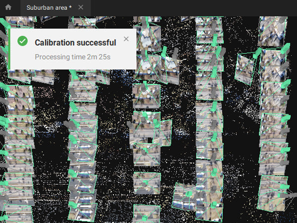
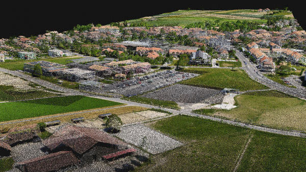
Bigger datasets, accurate results
PIX4Dmatic processes thousands of images while maintaining survey-grade accuracy, halving the processing time, without the trouble of splitting and merging.
Fully automated processing
Developed in close-collaboration with surveyors and mapping professionals to streamline your workflow: import, process and assess the quality of a project in just a few clicks, and move seamlessly from PIX4Dmatic to PIX4Dsurvey.
Terrestrial workflow
Leverage the benefits of both photogrammetry and LiDAR technology. Process LiDAR and RGB image outputs from PIX4Dcatch for a full terrestrial workflow. Easy and desktop-based.
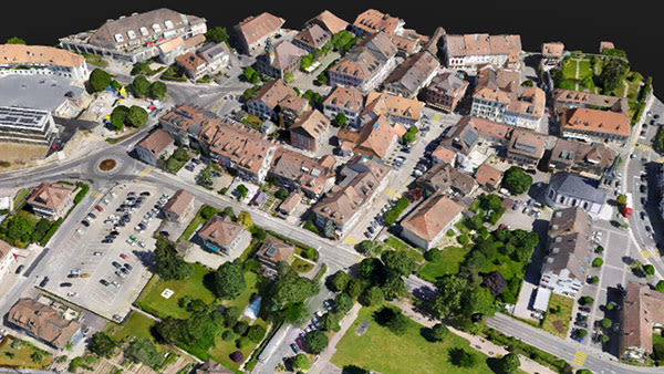
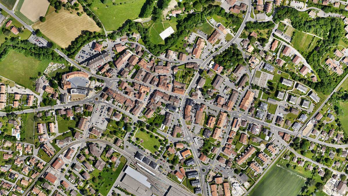
Accurate 3D maps and models from thousands of images
-
FAST PROCESSING
-
EASY ACCURACY CHECKS
-
VERTICAL COORDINATE SYSTEMS AND GEOID SUPPORT
-
IMPORT FROM PIX4DCATCH
-
FAST DEVELOPMENT CYCLES
Generate a dense point cloud, create a depth point cloud or fuse them according to the needs of your project and create the best reconstruction possible.
Export formats: .laz .las (1.2 and 1.4) .xyz
Create orthomosaics that are geometrically corrected such that the scale is uniform. They are color balanced in order to be visually pleasing.
Export formats: .tiff (GeoTIFF) .jpg (Georeferenced with .jgw) .tfw .prj
Generate a digital representation of all objects in the mapped area. It includes natural features as well as elevated objects, like buildings.
Export formats: .tiff (GeoTIFF) .tfw .prj
Generate a 3D textured mesh by defining the texture size and decimation criteria and view it either in textured or shaded mode.
Export format: .obj .slpk Cesium 3D Tiles .laz
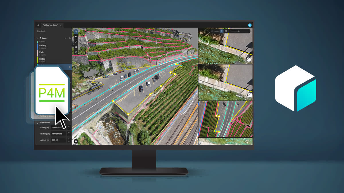
Seamless export of processed projects into PIX4Dsurvey to transform point clouds into actionable CAD-ready data. Pix4D's proprietary .bpc file format is optimized for loading and manipulation of big point clouds.
Export format: .p4m
Seamless export of processed projects into PIX4Dsurvey to transform point clouds into actionable CAD-ready data. Pix4D's proprietary .bpc file format is optimized for loading and manipulation of big point clouds.
Export format: .p4m
Software available in English, Japanese, Spanish, French,
Simplified Chinese, Traditional Chinese, Korean, German, Portuguese, Turkish
Simplified Chinese, Traditional Chinese, Korean, German, Portuguese, Turkish
Share