Advanced Drone Solutions BC Inc.
PIX4Dfields
PIX4Dfields
Couldn't load pickup availability
PIX4Dfields
Hybrid drone and satellite mapping software for aerial crop analysis and precision agriculture
Saving time, money, and agricultural inputs has never been easier.
Compatible with industry leaders
Ready-to-use & customizable variable rate and spot spraying maps for spray drones, tractors, and field sprayers.
[DJI Mavic 3 Multispectral dataset]
Seeing beyond the surface with the DJI Mavic 3 Multispectral and PIX4Dfields
Try a DJI Mavic 3 Multispectral demo dataset yourself! Process it with PIX4Dfields and let the magic happen. Start saving time, money, and resources in your agriculture workflows today!
Create and use prescription maps directly with your machinery - no third party software needed
WEBINAR
How to successfully plan your agricultural spray drone flight with PIX4Dfields
Join us for a discussion on how to use PIX4Dfields RTK field boundaries and obstacle editing for spray drone applications, and talk about the importance of ensuring an efficient and profitable flight.
-
FAST PROCESSING - ACCURATE PROCESSING
-
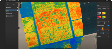
GENERATE INDICES
-
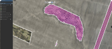
ZONATE AND PRESCRIBE
-
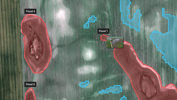
MEASURE AND ANNOTATE
-
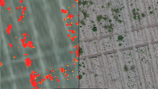
MAGIC TOOL
-
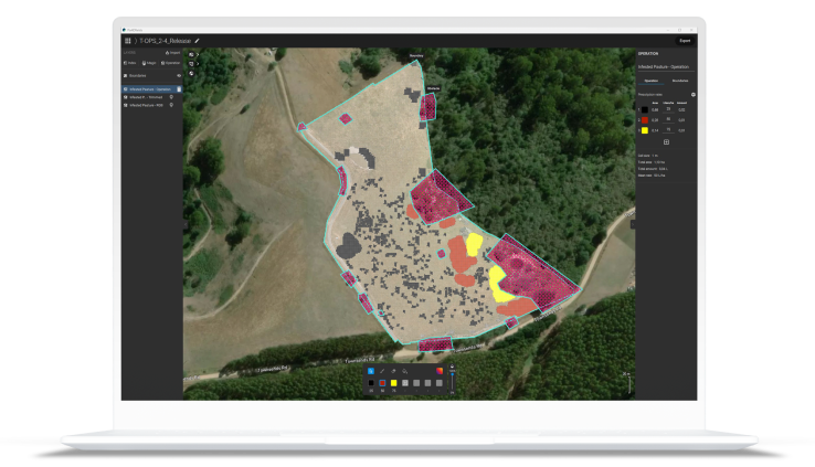
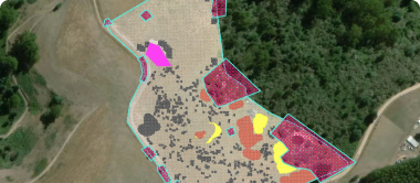
TARGETED OPERATIONS/PRESCRIPTION MAPS
-
JOHN DEERE OPERATIONS CENTER
Easily scout your farm and generate the appropriate output for your needs.
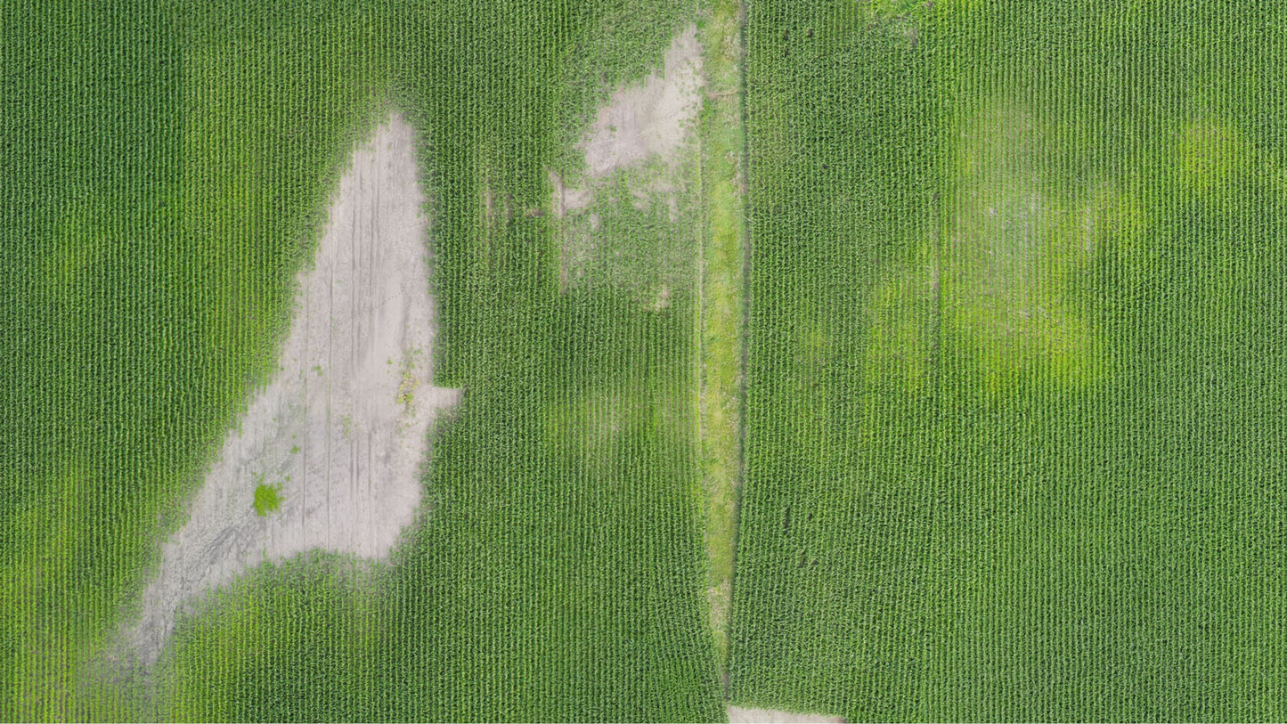
Orthomosaic
Export formats: GeoTIFF, High-Resolution JPG
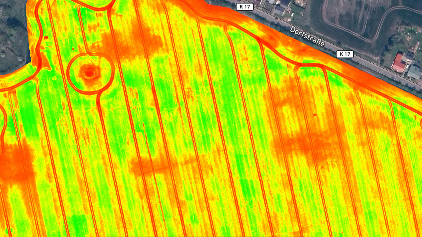
Vegetation index maps
Use a predefined list of vegetation indices like NDVI or use custom index formulas for a more comprehensive understanding of your crops.Download an example vegetation index map
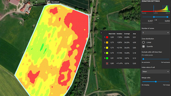
Zonation maps
Export formats: Shapefile, KML, GeoJSON, GeoTiff, High-Resolution JPG
Export formats: GeoTIFF, High-Resolution JPG
Annotations
Export formats: Shapefile, KML, GeoJSON
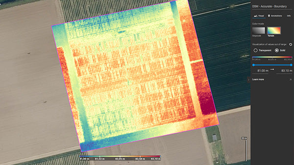
Digital surface model (DSM)
Export formats: GeoTIFF
Start saving today!
Customizable prescription maps for your spray drone, tractor, or field sprayer!
Targeted Operations: export maps for different brands (DJI, John Deere, XAG, and more!)
Spot Spraying - Prescription maps
DJI Example (Spot), XAG Example, Shapefile Example (Spot), ISOXML Example (Spot)
Export formats: Shapefile, KML, GeoJSON, ISOXML
Variable Rate - Prescription maps
DJI Example (VRA), XAG Example, Shapefile Example (VRA), ISOXML Example (Spot)
Export formats: Shapefile, KML, GeoJSON, ISOXML
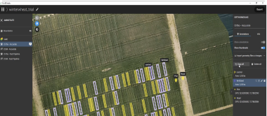
Field boundaries & obstacles
Export formats: Shapefile, KML, GeoJSON
User-friendly exports
Enhance your business services
PDF report
Aggregate all the project information you need in a PDF report for easy sharing and collaborating.
CSV export
Aggregate all the statistical information you need in a .csv export for easier trial plot management.
John Deere Operation Center
Connect to your Operation center account and share high-resolution drone and satellite images! Upload boundaries, aerial maps, crop health maps, maps for variable rate and spot spraying applications.
Pix4D Share-to-Cloud
Share to PIX4Dcloud is a feature of PIX4Dfields which makes it easy to share 2D layers over the internet with just a web link. It enables the connection of a PIX4Dfields desktop project to PIX4Dcloud.
High-Resolution snapshot
Export your layers as high-resolution JPG or PNG with customizable resolution, for social media, mail, or print
Software available in English, Japanese, Spanish, French,
Simplified Chinese, Traditional Chinese, Korean, German, Portuguese, Turkish
Share